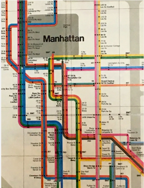
New York Subway map
John G Ellis
Subsequently published in NY Access with Richard Saul Wurman
A new design for the New York Subway reimagined to be more accurate in terms of the actual shape of the city. In contrast to the current map by employing a 60/30 degree geometry on top of the orthoganal map grid, it is possible to create a diagram that aligns streets such as Broadway with its diagonal path across the Manhattan street grid, and to represent Central Park in its true propostions.
The map also includes Metro North, New Jersey Transit and Long Island Railroad lines as part of a wider transit network.
The map was created in 1982 and first published in Richard Saul Wurman’s NYC Access guide in 1983.

New York subway map by John Ellis 1982.
Massimo Vignelli's 1972 subway map. A flawed classic. Central Park as a square! Transfers between lines are impossible to read. Too many colours.

John Ellis map with the 60/30 degree angles and the correct proportions for Central Park and a more accurate alignment for Broadway across the grid.